
Topographical Features of Gran Canaria
Central Highland and Volcanic Peaks
Gran Canaria’s landscape is dominated by a central highland region, highlighted by the Pico de las Nieves at 27.9656°N, 15.5814°W, with an elevation of 1,949 meters. This central massif divides the island into distinct northern and southern regions. The northern slope is characterized by steep escarpments and deep ravines, such as Barranco de Guayadeque, indicative of significant erosional processes and volcanic activity. These ravines radiate from the central highland, showcasing the interaction between volcanic formations and erosion. In contrast, the southern slope descends more gradually, presenting a varied terrain influenced by the central massif’s gradient.
Coastal Periphery and Ravine Networks
Gran Canaria’s coastal periphery features significant topographical contrasts. The northern coast has rugged cliffs and narrow coastal plains, while the southern coast is defined by gentler slopes and broader beaches. This topographical variation is due to differential erosion rates and volcanic processes. The island’s complex network of ravines is more pronounced in the north, forming an intricate drainage system. Valleys like Agaete and Tirajana, with fertile soils, are shaped by the convergence of ravines, reflecting Gran Canaria’s dynamic geological past. The topographical diversity from the volcanic central highland to the coastal edges makes Gran Canaria a unique geographical entity.
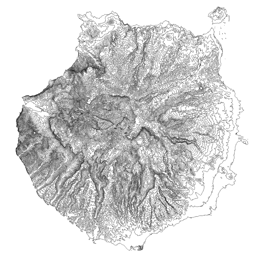
Fig1. Illustration of the topography of the island of Gran Canaria.
Fig2. 3D topography rendering of the island of Gran Canaria.