
High-Resolution Wind Flow Analysis on the Northwest Coast of Gran Canaria
Today, we explore surface wind flow on the northwest coast of Gran Canaria, using advanced modeling tools and technologies to deliver highly detailed insights.
Advanced Modeling Tools: WRF, CFD, and HPC
We utilize the Weather Research and Forecasting (WRF) model, a powerful tool for atmospheric research and forecasting. Combined with Computational Fluid Dynamics (CFD), we can model wind flow over Gran Canaria’s diverse terrain. High-Performance Computing (HPC) processes these extensive datasets, enabling us to run high-resolution simulations efficiently.
Instantaneous Time Snapshots
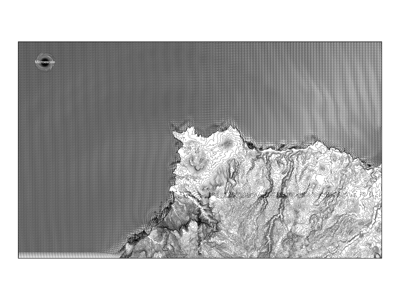
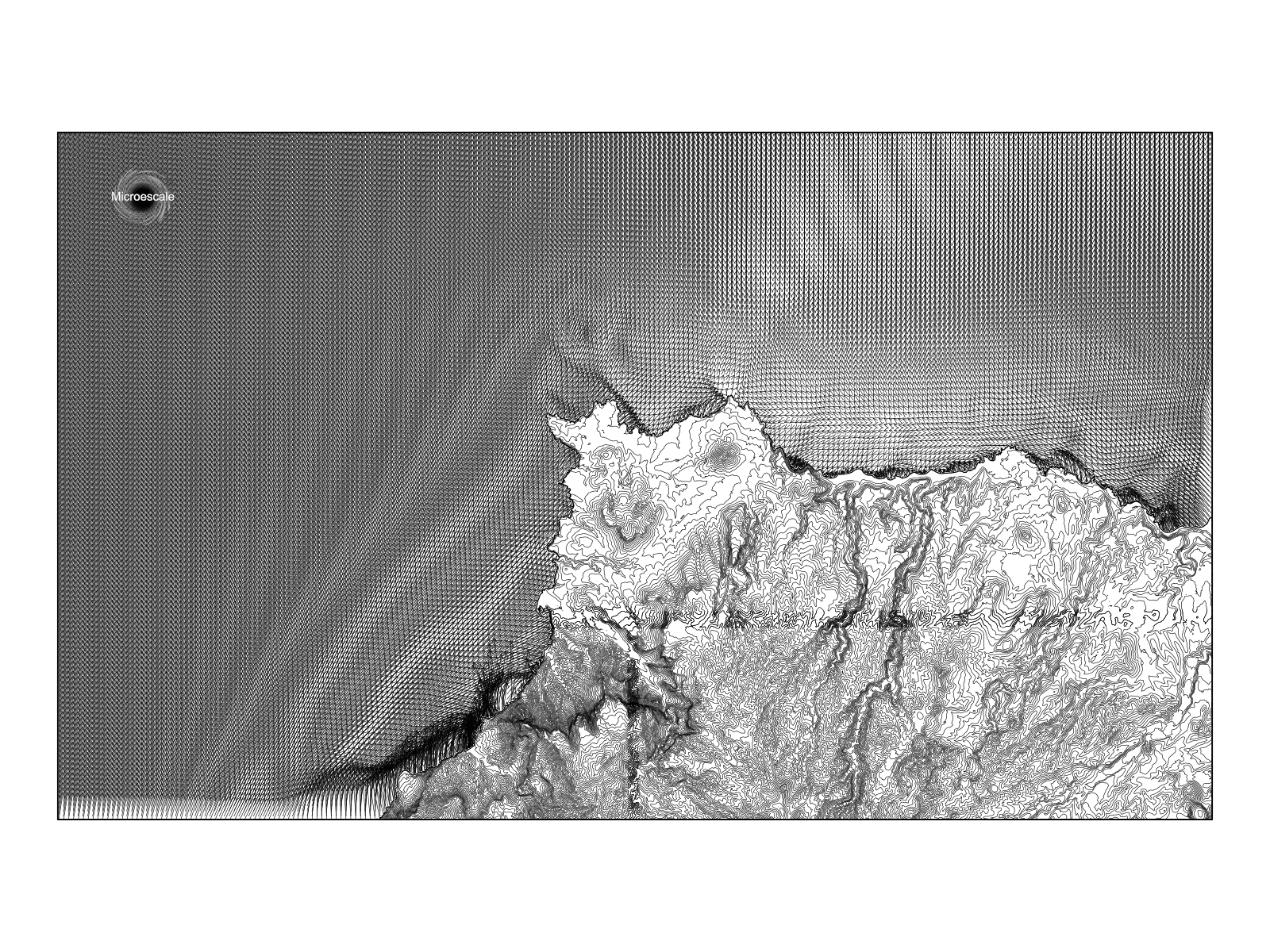
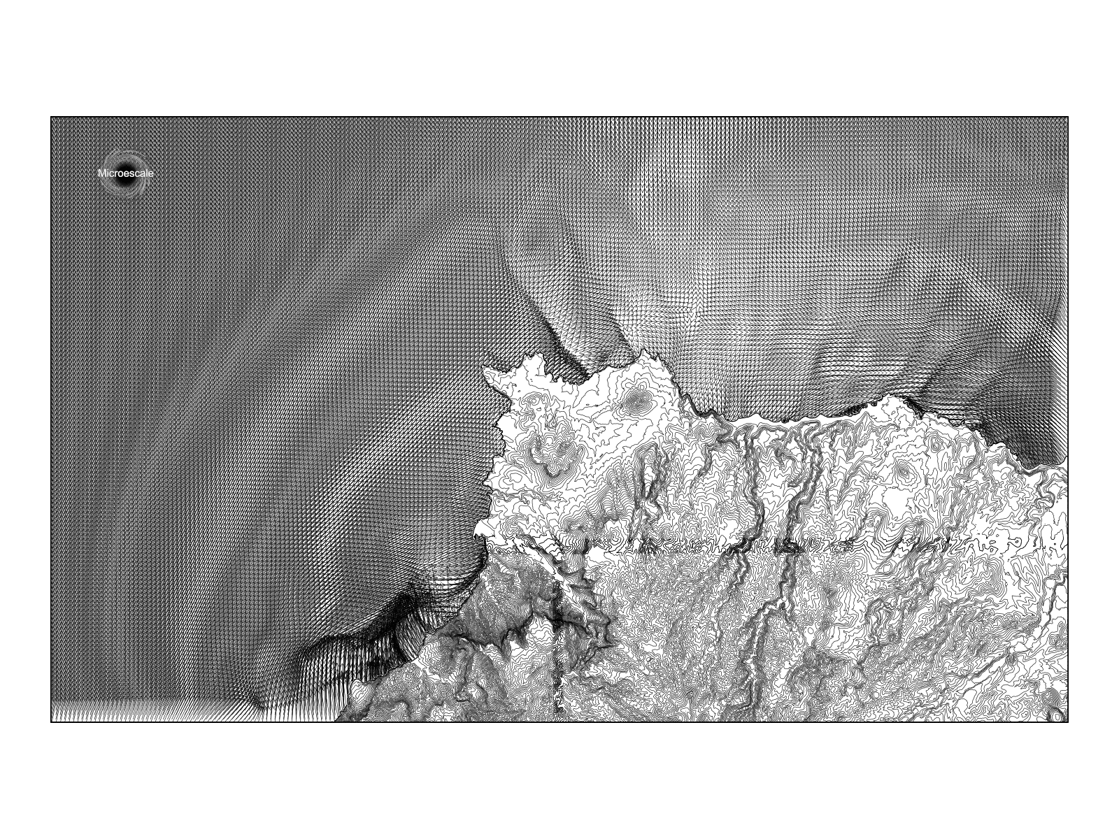
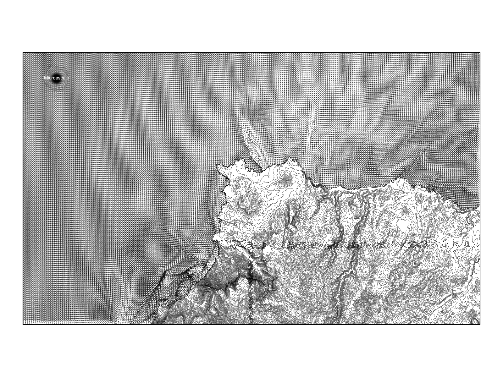
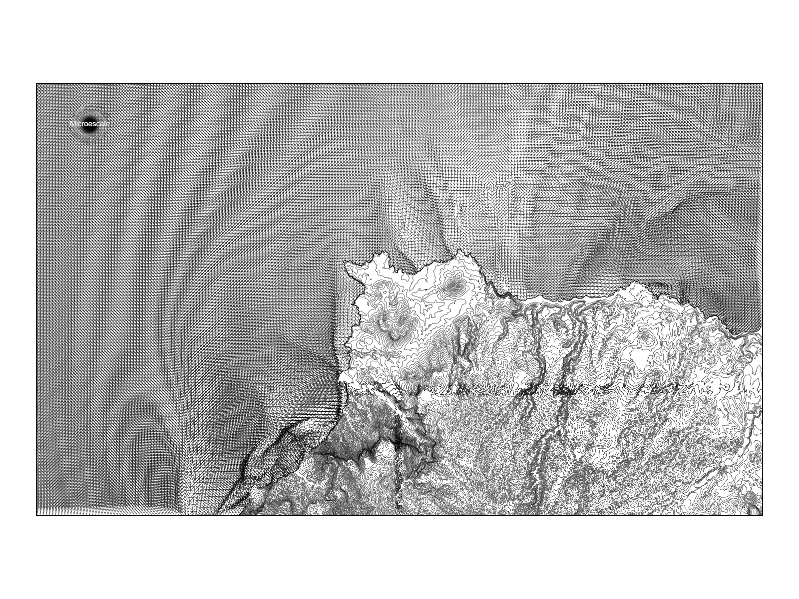
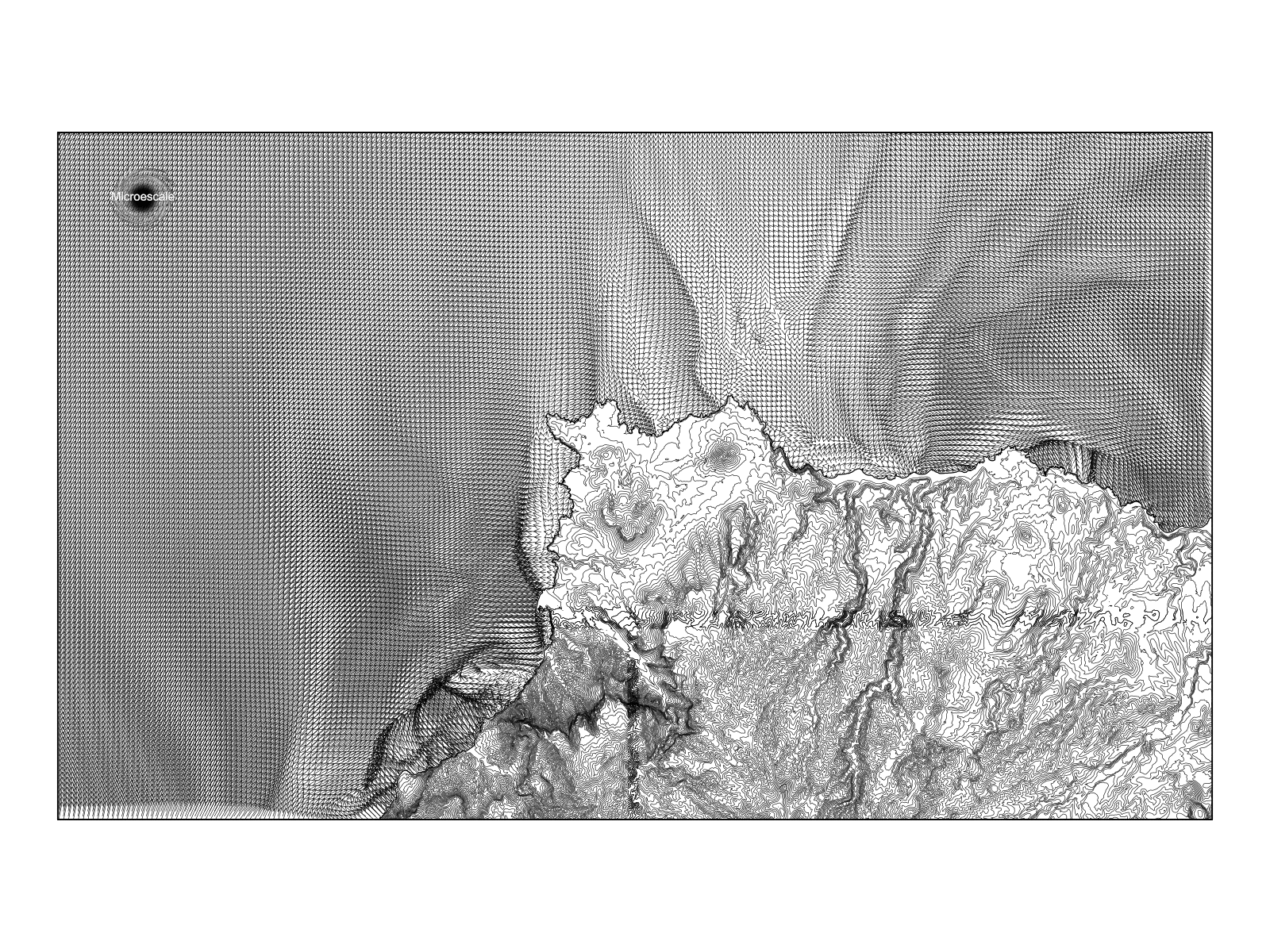
We present instantaneous time snapshots to illustrate surface wind dynamics. These snapshots reveal the complexity and variability of wind patterns, highlighting how wind flow evolves in response to environmental conditions. Zoom in to see details.
High-Resolution Spatial and Temporal Analysis
Our analysis covers the northwest coast of Gran Canaria at a spatial resolution of 200 meters, capturing detailed wind patterns and interactions with the island’s features. We also capture data at 1-minute intervals, providing a granular view of wind flow changes over time.
At Microescale, we aim to deliver detailed meteorological analyses. By leveraging WRF, CFD, and HPC, we provide high-resolution insights crucial for research. Stay tuned for more in-depth explorations into meteorology and environmental science.
Tags: #GranCanaria #WindFlow #WRF #CFD #HighResolution #Meteorology #SurfaceWinds
Feel free to comment below with your questions or thoughts. We look forward to engaging with our community and sharing more exciting discoveries in future posts. Contact me!.